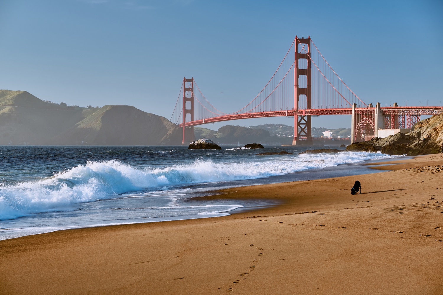
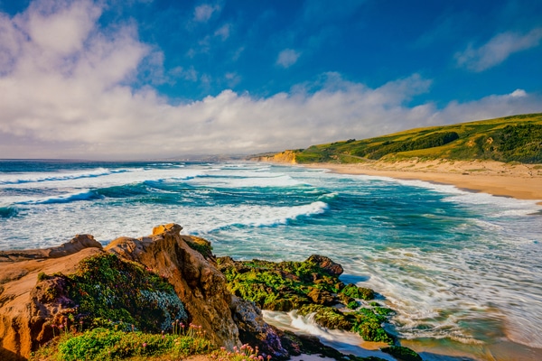
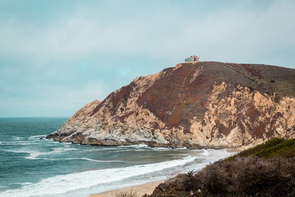
Baker Beach
Baker Beach is hard-to-miss, and it is a beach famous for its postcard-worthy shots. Stay within the city area and get a breath of fresh air, enjoy the scenery or just fly a kite. It still makes our best beaches list because, well, no one ever gets tired of the neighborhood beach.
If it’s the iconic view of the Golden Gate Bridge that you are looking for, Baker Beach hits the spot. The sandy coast stretches a mile west of the bridge and is the perfect setting for tourist photographs and a radiant atmosphere.

Proximity is the key to making this a go-to stopover. A quick trip to Baker Beach is all you need to erase the week’s stress and anxiety, which is why locals won’t ever get tired of this.
Things to do while at Baker Beach
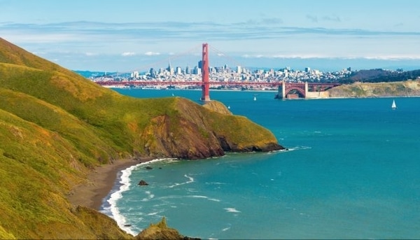
Baker Beach promises magnificent views of the Golden Gate Bridge and Marin Headlands. Located in the Golden Gate National Recreational Area, you’ll never run out of activities such as picnics or hiking along the Coastal Trail. Trek along the sand ladder and Batteries to Bluffs Trail for an inspiring rock walk.
Complete your cultural experience with historical landmarks. The Batter Chamberlin features a defense site with a “disappearing gun” while a lengthier walk takes you to the World War II West Coast Memorial.
You can set up a picnic area and chance upon sea lions or porpoises if you get there early enough. Fishing spots are also available for those who wish to take long and scenic breaks.
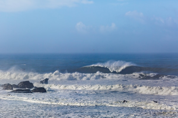
Swimming is not allowed with the strong waves in this area. Don’t bother battling the current. Instead of finding lifeguards, you’ll find yourself battling with crowds, so best to get a head start and visit Baker Beach in the earlier hours.
Facilities at Baker Beach
Picnic areas are abundant and are spread along this mile-long strip. Restrooms and parking lots are also available.
How to get to Baker Beach
You can take a car, public transport, or bike to reach Baker Beach. You can take the 38 Geary Outbound Muni Bus, then move to the 29 Sunset if taking a bus. Take Lincoln Boulevard and follow the signs to get to your beach destination if you are driving. Free parking lots are available, but these fill up very fast on a sunny day. Baker Beach is located at the end of Bowley St. and Gibson Rd., San Francisco, CA 94129
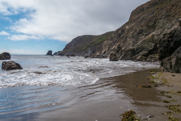
Black Sands Beach
Turn on your dark adventure mode with a trip to Black Sands Beach in Shelter Cove, California—just a few minutes away from San Francisco. It’s quite a no-brainer why this was named Black Sands, so if a trip to a secluded beach is what you’re planning, then make this the top of your list.
Getting to the beach includes a downhill hike of about a mile from the parking lot. Just remember the mission: you must see the black sand. Save your strength because you’ll be taking the same route back! There will be a lot of hiking involved, so backpackers and walking enthusiasts would find this a thrilling journey.
The 3.5-mile beach strip of dark sand adds to the dramatic feel. Blanketed by lush hills and fog, the secluded aura is enough to bring comfort to travelers. It’s beckoning in a way to just sit back on a comfy rock or explore the area for logs, shells, and what-not. Find a rock formation that inspires you or take gorgeous photos on the hidden paths. A springtime visit means that the vegetation will be in full bloom—an excellent contrast to the grayish tones of the sand.
Things to do while at Black Sands Beach
Swimming and other water activities are not advised, primarily because of the strong currents or potential high tide. Best to explore the sandy strip and rock formations instead. The view is breathtaking, so hiking capped with a picnic is the best way to enjoy Black Sands Beach. Bring just enough food that wouldn’t be difficult to carry down the beach.
If you’re in for some serious backpacking, you can hike up to the Lost Coast Trail. There are wilderness camps available for overnight sleeping.
If just passing through the area as a side trip, Black Sands Beach is a must for a stopover. Let the dark side welcome you, even for less than an hour.
There are free parking slots but are limited in number, which may also be why the guests at a certain point are constrained. It is recommended to visit Black Sands Beach earlier in the morning to secure a parking slot.
Facilities at Black Sands Beach
There are no facilities on the main beach area, so if you need to use the restroom, you’ll have to do it when you arrive at the parking area.
Before descending to the beach, you can access the restrooms and drinking fountain in the parking lot. There are also panels where you can read about the area—for some good ol’ science information.
How to get to Black Sands Beach
Head north across the Golden Gate Bridge and take exit 442 to merge onto Alexander Ave to get there by car. Turning left on Bunker Road, and another left on McCullough Road leads you to Conzelman Road. Continue on this route until you find Upper Fisherman’s Trailhead, the limited-spaced parking lot for Black Sands Beach.
Black Sands Beach is located on Beach Rd. and Humboldt Loop Whitethorn, CA 95589
Mavericks Beach
Surf’s up! Mavericks Beach or Pillar Point Beach in Half Moon Bay features the biggest surf break on the West Coast. Called Mavericks or Mavs (to hard-core fans), these 15 to 30 feet monster waves are adrenalin-pumping to watch and dangerously fun for the surfers.
Half Moon Bay annual surfing competitions happen once a year (between November and March), but you don’t need to attend the actual contest to enjoy the beautiful waves. The big breaks come towards winter, but you’re likely to experience the chill and smoother waves if you visit during the spring or summer.
Climb the bluff to get an incredible view of the waves and the surfers with binoculars. They call it the “Point,” or you can look for the giant golf ball. Even without the “fast and furious” Mavericks contest, the bluffs are an excellent spot to watch the surfers and the nearby beaches. Bring high-grade binoculars so that you can also do some whale watching.
There is also a harbor area that is a great place to walk your dog and do other recreational activities. The tamer water on this side is safe for paddle-boarding or kayaking.
Why is Mavericks such a challenging and powerful wave?
The beast comes to life when huge swells come out of deep water and onto the submerged rocky ledge a few hundred yards in front of treacherous rocks that protect the local lagoon. As the wave feels the reef, it rises and forms a tall A-frame peak with a thick lip.
Read more about the big break at Mavericks here.
The shoreline features about a half-mile stretch of an effortless beach trail. If you come across a surfboard, then lucky you. Beyond surfing, Pillar Point Beach showcases wetlands, a salt marsh habitat, and rock formations. There is a lot to explore on the sand and marshy area—from tiny crustaceans to plants.
Things to do while at Mavericks Beach
If you’re up to a hike, take the Pillar Point Bluff Trail to follow the coastal ridge and enjoy elevated views of the wild waves. There’s also fantastic scenery of the wildlife and birds as you trek around Pillar Point’s trails and bluffs. The sound of waves and the salty air can create that all-year-long summer vibe.
Surfing and fishing are other activities that you can enjoy, not to mention a bit of sailing. When you’re done with the energetic tasks, you can always hang out in the surf shops or patios to get the surfer life feel.
Sometimes, the best moment in life is just taking in the view and having a break. Chill out.
Facilities at Mavericks Beach
There are toilets and friendly trails, usually beside the free parking spots.
Since Mavericks Beach is known for its wild waves, always remember never to turn your back on the ocean. Eyes always on the water and the cliffs.
How to get to Mavericks Beach
You can get there by car. From Highway 1, go to the Half Moon Bay Community of Princeton-by-the-Sea. Go north to West Point Ave. until you reach the Pillar Point Marsh parking lot at the end. You can descend on the trail from there to the harbor.
Mavericks Beach is located at W Point Ave. Half Moon Bay, CA 94019.
Stinson Beach
Within the 82,000-acre Golden Gate National Recreation Area is Stinson Beach in Marin County. An hour’s drive from San Francisco takes you to these shimmering shores. White sand makes this a pristine beach getaway with an oceanfront that offers a breather and calm as an urban escape.
Stinson Beach is one of the best swimming beaches in California. Highly accessible and with a breathtaking ocean view, this earns marks for being a glorious getaway for R&R and adventure seekers. Top up the experience further with a majestic background of Mt. Tamalpais and Muir Woods National Monument.
Things to do while at Stinson Beach
Don’t forget to pack your SPF and other gears and equipment because you’re in for many activities. You won’t get tired of things to do. Fishing, surfing, and windsurfing are common water activities at Stinson Beach. Walk along the beach and play games. You can also set up a volleyball area and start a game with new acquaintances.
If you just want to relax, have a stroll on the white sand and a picnic. The beach has picnic tables and barbecue grills to make your day-at-the-beach experience just unforgettable. There are also shops and restaurants near the beach so you’ll never get bored and hungry.
Facilities at Stinson Beach
Bathrooms and parking lots are available. There is a snack bar open during the summer or peak months. Picnic areas are spread around the beach if you wish to bring your food.
There are lifeguards available from July to Labor Day.
How to get to Stinson Beach
Stinson Beach can be easily reached via public transport, and the Marin Transit Bus #61 is a daily bus service.
Take Highway 1 and proceed to Stinson Beach. The signs will easily lead you to the beach. Be mindful of the steep and winding roads on the way. Plan your trips early before the parking lot fills out! If you plan to go there by car, it helps to call in advance in case of extreme weather scenarios.
Stinson Beach is located at 3785 Shoreline Hwy, Stinson Beach, CA 94970
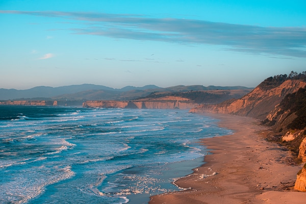
Pescadero State Beach
Did you know that Pescadero is a Spanish word that means “a place to fish?” There’s so much to see and do in Pescadero State Beach that makes the 55-minute ride from San Francisco worth it.
The mile-long shoreline in San Mateo County is just brimming with picture-perfect bluffs, mesmerizing sand dunes, and rocky coves. Rock formations bring a sense of adventure to nature walks, and the blast of sea breeze completes the outdoor experience.
Things to do while at Pescadero State Beach
You can choose from various water activities, like boating, fishing, surfing, windsurfing, and swimming, of course.
Explore the dunes and coves spread along the beach. There’s also an inviting rock arch that’s just too inviting to miss.
Still can’t get enough of the nature fix? The Pescadero Marsh Natural Reserve gives a glimpse of the wildlife, a must-visit for animal lovers and bird watchers. Watch blue herons, foxes, or even skunks and raccoons in their natural habitat. There is also a free guided marsh tour on the 1st and 3rd Sundays.
The preserve has hiking trails if you’re into more walking activities. There’s also a creek (Pescadero Creek Road), protected waters where you can kayak and do stand-up paddle-boarding. It’s another peaceful area for some nature viewing.
Bring a jacket or layers of clothing when visiting Pescadero State Beach because the shoreline weather is prone to changes.
Facilities at Pescadero State Beach
There are picnic areas at the beach and restrooms with no running water.
How to get to Pescadero State Beach
You can get there by car, on the west side of Highway 1. There are three parking lots at Pescadero State Beach. They all lead you to the beach.
Pescadero State Beach is located at Pescadero Creek Rd and Cabrillo Highway, Pescadero, CA 94060
Bolinas Beach
Situated in a town named Bolinas, this quaint beach brings serenity and quiet amid its rolling waves. Also called Brighton Beach, being at the mouth of the Bolinas Lagoon makes this an excellent spot for beginner surfers or those just raring to have some fun water activities.
Bolinas residents are known to remove signs to the beach—but remember the directions, and you shall prevail in reaching your destination.
Things to do while at Bolinas Beach
With soft waves and calmer waters, surfing, kayaking, stand-up paddle-boarding, and bodyboarding are all favored activities. Sunbathing and wading through the water are also fun activities to do.
Dogs are also allowed off-leash, but always make sure you clean up after.
Have a picnic, set up a small camp, or read a book. All’s well and fun in Bolinas Beach.
Make sure it’s low tide when you visit. While high tide poses no risk, your secondary access through Wharf Road may be wet during high tide. Low tide also allows you more walking area on the beach.
Facilities at Bolinas Beach
There’s a restroom and a tennis court. Street parking is available (with a fee) so make sure you’re early.
How to get to Bolinas Beach
You can get there by car, north of Highway 1 from Stinson Beach. You can access the main beach area at the end of Brighton Ave.
Bolinas Beach is located at Brighton Ave and Cliff Rd. Bolinas, CA 94924
San Gregorio State Beach
Your quest for an adventure-filled weekend will not be lost at San Gregorio State Beach. Rugged caves, lush cliffs, and a slumbering lagoon make this a 50-minute break from city life.
Enjoy walking along the beach with cliffs lining your path. How about spotting driftwood on the lagoon for an idyllic moment? Watch the birds and logs converge in their lagoon sanctuary. Wildlife viewing is inspired by this glorious view—complete with grassy cliffs and mysterious coves.
Did you know?
California Historical Landmark 26 commemorates the passage of Spanish explorer Captain Gaspar de Portola through this area in October 1759?
The northern end of the creek brings the Jurassic Park thrill—even for adults. With caves and fossils to explore, it can’t get any better than that.
Things to do while at San Gregorio State Beach
Swimming, fishing, and surfing are activities you can do on the beach. There are also caves to investigate and pockets of water that can host exciting wildlife. San Gregorio State Beach also has a creek that supports nature, so bird watchers, here’s a chance for you!
The picnic area sits on top of a bluff overlooking the beach for a uniquely charming experience.
Be wary of going beyond your trail and enter a nude beach. No worries—it’s just that you’ll be overdressed!
Facilities at San Gregorio State Beach
Restrooms, picnic tables, and barbecue sites are available. The parking lot is situated near the picnic tables. Relax and take in the grand view of the beach from above.
Camping and dogs are not allowed. Don’t even think about taking a fossil for your pet!
There is live music from Friday to Sunday. It looks like a neat place to stop before you head to the beach! You can also shop for supplies, goods, and other trinkets at the western vintage San Gregorio General Store, a mile away from the beach.
How to get to San Gregorio State Beach
You can get there by car, along Highway 1 (10.5 miles to the south of Half Moon Bay).
San Gregorio State Beach is located at La Honda Rd and Cabrillo Hwy, San Gregorio, CA 94074
Drakes Beach
Get your playlist ready. The journey to Drakes Beach at Point Reyes National Seashore may take about an hour and a half, but the picturesque route already sets the fun vibe.
The Kenneth C. Patrick Visitor Center would be an ideal first stop for some historical and cultural information about the explorations in the 16th century. It houses artifacts and fossils to complete the museum experience and will not be a dull side trip. You will need to know why it’s named Drakes Beach in the first place after Sir Francis Drake visited in the late 1500s. Sir Drake was not a pirate but an Englishman who sought to explore the world aboard “The Golden Hinde.”
It’s also a fitting name—since the sandstone cliffs set a dramatic backdrop for the mellow beach. White and majestic, the cliffs seem to jump from the setting of an English novel. Beautiful and mighty—these are a real work of nature. This beach is an excellent spot to catch up on some reading or get those editorial-worthy shots.
If you wish to get around the Point Reyes tourist spots, shuttle buses can take you around. They leave the parking lot every hour, beginning at 9:30 AM. For USD $5 per person, you can visit the Point Reyes Lighthouse and Chimney Rock. You can make your booking in the Visitor Center. Make sure to do so early in the morning to avoid crowds and long queues.
Drakes Beach is famous for its elephant seals sighting. While you can’t pet them, you can take photos and marvel at the pups.
Short trails and bluffs surrounding Drakes Beach give you a fantastic view of the beach. A combination of hiking and elephant seal viewing is something to look forward to. Exploring the beach or walking along the water’s edge is a relaxing enough idea.
Things to do while at Drakes Beach
Swimming, wading, and beach walking are all allowed at Drakes Beach. The cliffs and Chimney Rock shelter the beach from harsh winds and currents from the Pacific Ocean, resulting in tempered waves. With calmer waters, you can try paddleboarding. In colder weather, try to bring a wetsuit so that you won’t risk hypothermia. Make sure to bring warmer clothes and jackets during the colder months to protect you from the chilly breeze and fog.
If you visit Chimney Rock, the Elephant Seal Overlook gives you a better glimpse of the elephant seals. Chimney Rock also features exciting places like the Point Reyes Historic Lifeboat Station, exhibiting on boats. Get access to the Point Reyes Lighthouse and enjoy loads of commanding views from this site. Remember to check out the actual Chimney Rock, the sharp rock that allows Drakes Beach to be a proper Englishman’s beach—with grace and serenity.
One important note is always bringing drinks and snacks—for the long ride, the walks, and the tour. There will be a lot of hiking around scenic areas, and it’s possible that some cafes may be closed or your visit may come close to lunchtime.
Facilities at Drakes Beach
The Kenneth C. Patrick Visitor Center has restrooms, showers, and the Drakes Beach Café. You may want to check in advance if the Café is open when you visit. If you wish to bring your food and picnic supplies, that is fine. Drakes Beach has picnic tables and set up barbecue grills for your cooking needs.
How to get to Drakes Beach
Take Sir Francis Drake Boulevard and turn left onto Sir Francis Drake Boulevard to get there by car. Follow the road, and you’ll get to the free parking lot.
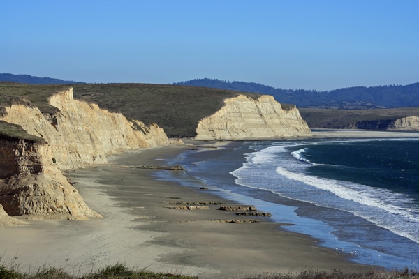
Montara State Beach
A cozy enclave surrounded by coastal cliffs best describes the postcard beauty of Montara State Beach (or McNee Ranch State Park) in San Mateo County. It’s the sculpted cliffs that make every moment dramatic, if not perfect.
The golden cove that stretches a mile long is scenic and attractive. Hikers and dog walkers will not be disappointed with the gorgeous view. Exploring tide pools would be much anticipated by the young ones. Pockets here and there make the beach walk much more exciting.
Things to do while at Montara State Beach
You can fish, surf, and do a bit of sunbathing. Unfortunately, no swimming is allowed in Montara State Beach.
Bike and hike trails are also found in the area. Some of the trails can lead you to Montara Mountain! If you head to the McNee Ranch State Park, north of the parking lot, you can head on to more adventures on the Gray Whale Cove Trail or Pedro Mountain Trail.
Facilities at Montara State Beach
Have a lovely picnic at the beach, but you’ll have to bring your equipment. There are restaurants and grocery stores nearby, so food shouldn’t be a problem. Ensure you use the restrooms in these establishments because there are none in the beach area.
With just a 25-minute ride from San Francisco, the Montara State Beach is such a good weekend deal! Stay there until the sunset so that you can fall in love with the golden hues on the coastal cliffs.
How to get to Montara State Beach
The beach is easy to find about 8 miles north of Half Moon Bay. You can get there by car by taking Highway 1. There is limited accessible parking available. You can access the beach in 2 ways: across Second Street and Highway 1 ocean side.
Montara State Beach is located at 2nd St and Cabrillo Hwy, Montara, CA 94037
Muir Beach
Muir Beach in Marin County is an excellent getaway if you’re looking to complete the fun beach experience. It is, after all, a community on its own and a census-designated place (CDP), so bonfires, sunsets, and dogs are all a big check in this friendly beach!
Muir Beach is a cozy cove that hosts a spectacular view of the ocean and a lagoon that’s great for bird-watching. The beach is wide enough for a large crowd to set up tents, picnic tables, and sunbathing areas. Beachcombing and walking the dog would be a great exercise, but so will exploring the multiple trails.
Swimming or checking out the tide pools would be an exciting activity for the kids. Starfish, crabs, and other shellfish are sure to be a delight to observe. There are no lifeguards in the area, so exercise caution.
The Redwood Creek flows through the beach and supports a lot of birds, frogs, and fish. You can come across the lagoon, wetlands, and marshy areas that add to the verdant hue of the beach. The creek area can also be home to foxes and deer—so wouldn’t that be a sight? If you visit in autumn, get a beautiful and rare sighting of the monarch butterflies on the pine trees!
Things to do while at Muir Beach
There are numerous hiking trails to choose from since the Muir Beach cove is 3 miles away from Muir Woods. The Dias Ridge Trail north of the beach features a magnificent ocean view. There is also Coyote Ridge towards the east. Just follow the signs from the beach that lead to the trail of your choice. The pedestrian bridge already connects to the beach, Coastal Trail, or the Kaashi Way. Lengthy explorations can lead you to a hidden beach (Pirates Cove) or a clothing-optional beach (that’s towards the north).
Bonfires and picnics are a definite must. Make sure your food and plates are layered and thick, or the winds can blow them to the next family. You can use the fire rings of the beach but observe the time limit. They’re also on a first-come-first-serve basis. The beach may have rules to extinguish the fire (using water) and the area one hour after sunset.
The Muir Beach Overlook is another place not to miss, which was once an army defense post. You can view the Pacific area and even up to the Point Reyes Peninsula in this strategic vantage point. Whale watching during winter is also a spectacle from this spot.
You can further explore historical areas and base stations when not viewing the area. The staircase leading to the overlook post is another must-see. Get your battle-ready pose on. There is also an available picnic area should you need to stay and spend a long time watching the migrating whales.
Did you know?
Although the main restoration project (of Muir Beach) was completed between 2013 and 2014, maintenance of this area is ongoing. The ecosystem continues to be monitored by the Golden Gate Natural Resources division and the San Francisco Bay Area Inventory and Monitoring Network.
Read more here about the Muir Beach Restoration project
Muir Beach started on a restoration program in 2009 to preserve Redwood Creek and promote a healthier and sustainable habitat for the animals and plants. This project resulted in a longer pedestrian bridge to keep people off these areas, among other restoration works and projects.
Facilities at Muir Beach
There is a restroom building near the parking area. You can also request beach wheelchairs if needed. Beach mats can also be requested during a specific period (April 2 to November 14).
Picnic tables are available near the parking lot. Fire pits or fire rings are available in the beach area.
How to get to Muir Beach
You should look for the Muir Beach Parking Lot. You can get there by car, north on Highway 1. Parking is free but can fill up quickly during holidays or weekends.
Muir Beach is located at 200 Pacific Way, Muir Beach, CA 94965
Rodeo Beach
While there won’t be horses to welcome you, there are cliffs, seagulls, and rocky paths to celebrate your arrival. The sand spit sits in between Rodeo Lagoon and the Pacific Ocean, so it’s delightfully windy, accompanied by birds and a colorful display of pebbles.
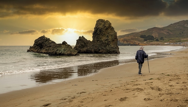
Rocky shores best describe the terrain you’re about to traverse, but the dark-colored hues of the occasional gemstones can stop you in your tracks. While it may be tempting to pocket a jade stone or two, remember to return them to Mother Nature.
Rodeo Beach will not fall short of any nature lover’s expectations. Get your fill of bird-watching by the lagoon. Pelicans, egrets, and herons would be a common sight—and so would frogs and fish! The coastal wildlife would be a fun viewing activity for the family.
Hiking or walking your dog along the pebbled trails would be enjoyable enough. The northern side brings hidden bunkers, Hill 88, and coastal views. Up until Battery Townsley, you can enjoy a meandering trail.
Things to do while at Rodeo Beach
Trekking towards the south end brings you to picturesque rocks that can frame the perfect sunset—a perfect way to cap your stroll. The trail also leads to military batteries like the Battery O’Rorke or the Battery Smith-Guthrie. The Bird Rock is an alternative spot to view birds with binoculars—but nothing beats viewing them up close.
While swimming is not allowed in brackish waters, surfing could be an alternative sport. Rockhounding is also allowed for rock and gem enthusiasts.
Picnicking in the beach area is a great idea to cool down, and so is the setting up of tents. Having a leisurely camp in the sandy area is the best way to relax and take in the rocky cliffs and waves. Remember to bring a kite or games to take a day from your hectic digital life with all that sand and breeze.
Remember to visit the Marin Headlands Art Center and Marine Mammal Center to add to the cultural experience. What’s great is that Rodeo Beach is about a half-hour away from San Francisco, so it could be a regular weekend trip.
Facilities at Rodeo Beach
There are restrooms and picnic tables available.
How to get to Rodeo Beach
From the Golden Gate Bridge, take the Alexander Ave exit (442) to get there by car. Look for signs to Marin Headlands through Bunker Road. This route will take you through Baker Barry Tunnel and Bunker Road until you get to Marin Headlands Visitors Center. Follow the path taking you north until you see the signs for the parking lot on Mitchell Road. That’s also where the picnic area is located.
Rodeo Beach is located at GGNRA at Marin Headlands, Sausalito, CA 94965
Tennessee Beach
Tennessee Beach should be your next getaway if hiking trails are your thing. It’s the hidden gemstone among the beaches near San Francisco because to get to it, and you’ll need to walk 1.8 miles through the Tennessee Valley Trailhead.
The views are charming—blanketed in green—and the valley on its own is a sight to behold. You’d forget that you’re just 20 minutes away from San Francisco with the all-adventure feel.
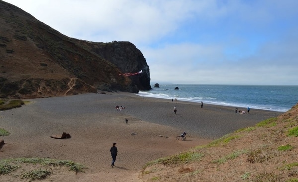
A freshwater pond welcomes you as you descend into the sandy beach. Like its neighboring beaches, the Tennessee Beach features dark-colored sand to add to the dramatic effect. Colossal rock walls surrounding the small beach lend an air of seclusion that can comfort those seeking solace or a retreat from the city.
Paved and sandy paths are there for your trekking pleasure. The idyllic views of a lagoon and hills will accompany your walks, and take the routes to the hills above the valley if you’re up for some advanced hiking. Take the wetlands route for a more scenic run—and you might come across some seabirds.
Things to do while at Tennessee Beach
No dogs allowed, though, in case that was the next question. Instead, you can bring a mountain bike and enjoy the lush views and cool air.
Swimming is not allowed—but you can spend your time picnicking, lazing around, or exploring the beach. Let the rocky path and sound of the waves engage your senses.
Take a stroll to the north end to see the formation (or what remains) of the iconic rock arch that collapsed on December 29, 2012. Robert Wills and his father witnessed this scientifically exciting moment—a testament to nature’s strong forces and the awe-inspiring moments that happen by accident.
Interesting fact – Check this out:
“With this, the collapse of the arch shortly followed, and the entire surrounding hillside started to slip off into the ocean in a thundering roar as boulders the size of a piano crashed into the surf and the sand sending up a large splash of debris that got me a little nervous despite my 100-meter distance. It all lasted less than 10 seconds and left the beach quiet in compassion, the roar of the surf nothing compared to the thunder of the rockslide.”
Robert Wills, an environmental science graduate student at Caltech, witnessed the Tennessee Beach arch fall.
Iconic Tennessee Beach arch suddenly falls into sea
The Tennessee Beach nature trip is not complete without a glimpse of flora and fauna. The valley is enriched with vegetation all year round and is adorned with the California state poppy flower. Depending on the time of your trip, you’ll see the color changes of the plants and blooms from verdant (spring) to golden (summer) with sprouting blackberry bushes and fennel at the end of the summer. As a coastal drainage and water source, wildlife is supported—especially birds. Feeding the wildlife isn’t recommended.
Tennessee Beach is frequently referred to as Tennessee Cove. After all, it’s the secret cove that highlights the beach trip. During low tides, you can get a glimpse of the engine of an 1853 shipwreck. The SS Tennessee docked in the cove when it couldn’t locate the Golden Gate entrance because of—you guessed it—the San Francisco fog. Even in 1853, the signature fog has been making waves.
Before the 1853 shipwreck, it was called Elk Valley.
Facilities at Tennessee Beach
There are restrooms available. Trails are also safe for walking, including children.
Since the walk from the trailhead to the beach is almost 2 miles, make sure you hydrate and bring adequate water.
Before your trip, you can make calls or check the low tide schedule so that you wouldn’t miss the SS Tennessee shipwreck sighting. High tides can also cut your access to the main beach.
How to get to Tennessee Beach
You can get there by car. From Highway 1 in the Mill Valley area, go to Tennessee Valley Road. Head west until you get to the trailhead parking lot at the end. Parking is free.